| STI: Market Sample Screen Shots |
|
Return to Previous Page |
In the shot below we show an overall view of the sample. The dark gray area is a relief map of the area. Each city region has been carefully color coded. The major roads are represented by green, black and red lines. Finally, the water regions (shown in light blue) are complete and refined. 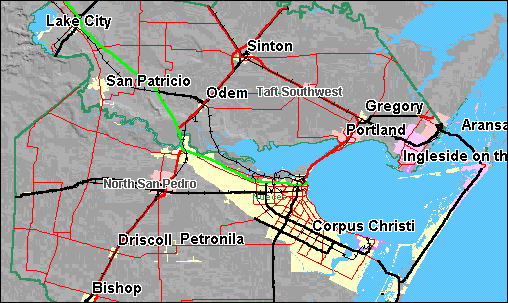 In this next shot a closer view of the city is taken. Notice how even the airports show the landing strips. The small 'H' in a white box represents hospital locations. 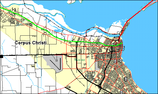 In this last shot an even closer view of the city is taken. Churchs and schools are now being displayed. There are over 15 point layer classes available for diplay. You can now see a better view of the major roads (a thin red line). Remember, no other data package has this level of detail for major road in similarly priced data packages! 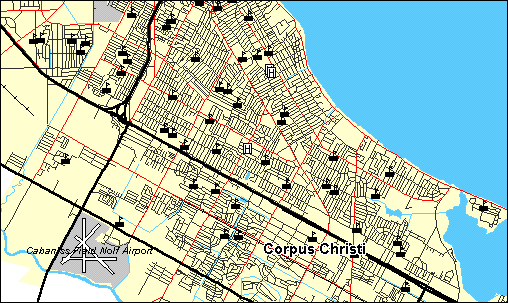 |
|
|