| STI: Streets |

|
| ||||||||||
 Approximately every six months the US Census Bureau releases their hugely popular
TIGER/Line® files. Synergos Technologies goes that extra step to convert these
files into an immediately accessible data package for the market leader in desktop mapping --- MapInto®.
You will receive over 30 layers of geographic data moved directly from the TIGER format.
Each layer has been carefully color-coded, thereby yielding the best presentation maps possible. And freeing the
user from the time-consuming chore of devising a coloring scheme.
Of course, it is the street element that most GIS users require. Therefore, like the other layers, we have carefully
color-coded each street segment and preserved the address ranges just as they came from
the Census bureau.
Approximately every six months the US Census Bureau releases their hugely popular
TIGER/Line® files. Synergos Technologies goes that extra step to convert these
files into an immediately accessible data package for the market leader in desktop mapping --- MapInto®.
You will receive over 30 layers of geographic data moved directly from the TIGER format.
Each layer has been carefully color-coded, thereby yielding the best presentation maps possible. And freeing the
user from the time-consuming chore of devising a coloring scheme.
Of course, it is the street element that most GIS users require. Therefore, like the other layers, we have carefully
color-coded each street segment and preserved the address ranges just as they came from
the Census bureau.
| Highlights | ||||||||||||||||
| STI: Streets |

| |||||||||||||||

| Tell Me More | ||
| Collectively over 30 data layers |
The following lists the layers that can be found in STI: Streets. Important not every
county will necessarily contain every geographic layer.
                                                File
  Description                                   Code
  -----------------------------------------     ----
  Points
     Zip+4's                                    zp4
  Line
     Streets                                     st
     Highways                                   hwy
     Limited Access Highways                    int
     Railroads                                  rlr
     Powerlines                                 pwr
     Air Strips                                 ars
     Waterways                                   wt
     Waterways (intermentent)                    wr
  Boundaries
     Block                                      blk
     Block Group                                bkg
     Tract                                      trt
     County                                     cnt
     Urban Areas                                urb
     School Districts                           sdu/sds/sde
     Incorportaed Places                        plc
     Voting Districts (VTD)                     vot
     Congressional Districts                    cng
     State Districts                            stu/stl
     Indian Tribal (various)                    ind/itr/akn
     Metropolitan Divisions                     msd
     Metropolitan Statistical Area/
        Micropolitan Statistical Area           msa
     New England City and Town Areas (NECTA)    nec
     New England City and Town Divisions        ncd
     Minor Civil Divisions                      mcd
     Census Designated Places                   cdp
     Zip Code Tabulations Areas (ZCTAŻ)         zct
     Public Use Microdata Areas (PUMAs)         pum
     Traffic Analysis Zones (TAZ)               taz
     Transportation areas                       trn
     Water                                      wtr
     Military Reservations                      mil
     Parks                                      prk
     Landmarks                                  lmk
     Golf courses                               glf
     Cemeteries                                 cem
| |
| Samples | ||
| STI: Streets Sample |
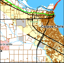
If you are a current MapInfo® user, you may download a sample of a county here.
The sample county is Nueces County Texas, where Corpus Christi is located.
The download is compressed in PkZip format (if you do not own PkunZip, click here) and once decompressed will be over 11.3mb in size! Download the sample NOW! | |
|
|